Redlining History

Redlining comes from color-coded maps created by the government sponsored Home Owners' Loan Corporation, who determined which areas of cities the government should insure mortgages through various New Deal programs of the 1930s. They looked at 239 cities and created "residential security maps" to indicate how “safe” real-estate investments were in each analysed city. Denial of credit, insurance, healthcare, and food deserts in minority neighborhoods ensued. This initiative was rooted in the belief that if African Americans were to buy homes near whites, white property values would suffer. Atlanta banks for example would often lend in lower-income white neighborhoods, not in middle or even upper-income Black neighborhoods. This ideology was not rooted in any fact as African American homeownership increased property value, since African American families were willing to pay more money for smaller houses than white ones, given that they had fewer options. African American families were restricted to the inner cities where they could not gain home equity or even think of building generational wealth. Redlining exacerbated residential racial segregation and urban decay in the United States.

About 85% of the residents of such neighborhoods were white, they included most of the African-American urban households, only six majority African-American neighborhoods in the entire United States were not evaluated as "Type D. Between 1945 and 1959, African Americans received less than 2 percent of all federally insured home loans.

Redlined Brooklyn
Redlining Color Code

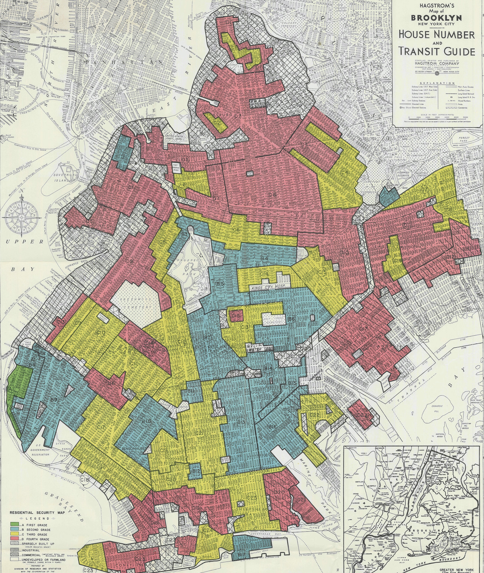
Green: New, desirable, affluent suburbs on the outskirts of cities are Type A. Blue: Still desirable neighborhoods are Type B. Yellow: Older areas are declining, Type C. Red: Exceeding a 5% Black population, the riskiest and undesirable neighborhoods are Type D.